
Lakes Basin Hikes for Mixed-Ability Families
A practical guide to Lakes Basin's easiest family hikes near Graeagle, from paved overlooks to short lakeside loops for all ages and abilities.
Quick answer: For a mixed-ability family, compare three genuinely different outings: the paved half-mile route to the Frazier Falls overlook, the 1.6-mile accessible Madora Lake loop, and the 0.8-mile Grassy Lake trail. Paved does not automatically mean easy for every wheelchair user: the Forest Service rates Frazier Falls difficult for wheelchairs and says assistance may be needed. Stronger hikers can use the same Lakes Basin corridor for the 2-mile Bear Lakes Loop or the roughly 1-mile approach to Smith Lake. Confirm road, snow, and trail conditions before leaving Graeagle.
Why Lakes Basin Suits Mixed-Ability Families
The Forest Service maps more than 30 miles of signed, maintained trails around the Lakes Basin's alpine lakes. Several trailheads branch from the same Gold Lake Highway corridor, which lets a family compare a short overlook walk, an accessible lake loop, and a moderate hike without planning three separate day trips. The routes are not interchangeable, though: surface, grade, creek crossings, parking access, and seasonal conditions differ. Pick the route from those details, not from a generic easy label.
Frazier Falls: Short, Paved, and Not Barrier-Free
The Forest Service trail guide lists Frazier Falls as a half-mile each way from the parking area to a fenced overlook. The surface is paved and the grade is modest, but the agency rates wheelchair use as difficult and notes that assistance may be needed. That distinction matters: families should choose the route for its short distance and clear destination, not assume that pavement guarantees independent access for every mobility device.
The 176-foot waterfall is strongest during spring snowmelt and can be much quieter later in the season. Check the current Forest Service recreation page before leaving, especially after winter or a storm, and carry water even though the walk is short. Our detailed Frazier Falls guide covers the stop in more depth.
Madora Lake: The Most Useful Accessibility Detail
California State Parks describes the Madora Lake Trail as a 1.6-mile accessible loop with a mostly compacted-aggregate surface. The route is generally below a 5 percent grade, with intermittent sections between 5 and 8 percent. The trailhead has accessible parking, a picnic site, and a generally accessible vault restroom.
Those measurements are more useful than a blanket label such as stroller-friendly. State Parks also warns that armored water crossings can be challenging during rain. Families using wheelchairs, walkers, or strollers should review the current accessibility page and recent weather, then decide whether the surface and grades suit their equipment and assistance plan. The park is five miles west of Blairsden on County Road A-14.
Grassy Lake and Bear Lakes: Two Clear Next Steps
The Forest Service trail sheet lists the Grassy Lake Trail at 0.8 mile and rates it easy. It begins at Lakes Basin Campground, passes Grassy Lake, crosses Gray Eagle Creek, and connects with the Long Lake Trail. A creek crossing and an easy agency rating are still reasons to check current conditions rather than promise a dry, obstacle-free walk.
For a longer family option, the same official guide lists Bear Lakes Loop as 2 miles round trip and moderate. It passes Big Bear, Little Bear, and Cub lakes and connects with longer routes. The campground approach is narrow and winding and does not accommodate trailers or large vehicles. Our Gold Lake Basin day-trip guide can help the group combine one hike with a few lower-effort lake stops.
Stepping Up: Smith, Round, or Silver Lake
Stronger hikers have several ways to add distance without inventing a one-size-fits-all loop. The Forest Service overview puts Smith Lake about 1 mile from its trailhead on a route rated moderate. The full Smith Lake Trail continues farther and connects with the Mount Elwell, Smith Creek, and Jamison Creek trails, so watch junctions and agree on a turnaround point before separating from the rest of the group.
Round Lake Trail is listed at 1.7 miles to the old mine site and 2.4 miles each way to the Pacific Crest Trail. Silver Lake is a more demanding choice: the agency lists 3.2 miles each way to the PCT, including part of Bear Lakes Loop. These are separate route descriptions, not a promise that every connector will make a simple family loop. Use the current map, choose one objective, and turn back early enough to reunite before dark.
Planning the Day: Access, Weather, and Turnarounds
Lakes Basin is southwest of Graeagle along Gold Lake Highway, but mountain-road time varies with weather, traffic, and the chosen trailhead. The Forest Service says the camping season usually begins in early June and ends in mid-October, depending on weather. That is a planning range, not a guarantee that the road, campground, water, or every trail is open.
Check the current recreation page and road conditions on the morning of the outing. Download the Forest Service map before leaving reliable service. Carry water, sun protection, food, and a warm layer; write down the group's routes and reunion time if hikers split up. The safest mixed-ability plan is usually one short shared outing followed by one optional extension, not several optimistic trail commitments.
Backpack camping is restricted to named lakes in the Forest Service guidance, and day-use rules can change with fire or weather conditions. Anyone planning an overnight should use current agency instructions rather than treating a day-hike article as permit guidance.
Where to Stay Between Hikes
A Graeagle base makes it realistic to string together an easy morning walk, a lakeside lunch, and a longer afternoon hike for the more ambitious members of the family without long drives in between. The Family Cabin in Graeagle with King Bed & EV Charging sleeps up to 12 guests across three bedrooms, which suits multigenerational groups splitting into different hiking paces. After a day on the trail, the wraparound deck, stone fireplace, and full kitchen make it easy to regroup, and the property's Level 2 EV charger and free parking for three cars simplify logistics for families arriving in more than one vehicle. Board games and a pool table give tired legs something to do once the hiking is done for the day.
Quick answers
Which route has the clearest accessibility information?
Madora Lake. State Parks publishes the 1.6-mile distance, surface, width, grades, water-crossing warning, accessible parking, picnic site, and restroom information. Review that page against the needs of the person and equipment in your group.
Is Frazier Falls wheelchair accessible?
The route is paved, but the Forest Service rates wheelchair use as difficult and says assistance may be needed. Do not equate a paved surface with independent access.
How long is the Bear Lakes Loop?
The Forest Service lists it as a 2-mile round trip with a moderate rating. It passes three lakes and connects to longer trails, so follow the intended loop rather than an unverified app route.
When is Lakes Basin usually accessible?
The Forest Service says the camping season usually runs from early June to mid-October, depending on weather. Snow, fire restrictions, storms, and road work can change access, so verify conditions for the exact date.
Will cell service work throughout Lakes Basin?
Do not depend on it. Download the agency map and current pages before leaving Graeagle and keep the group's routes and reunion plan available offline.
Sources
- Lakes Basin Recreation Area — USDA Forest Service
- Lakes Basin Trails — USDA Forest Service, Beckwourth Ranger District
- 30 Best Things to Do in Plumas County — Discover Plumas County
- Accessible Features at Plumas-Eureka State Park — California State Parks
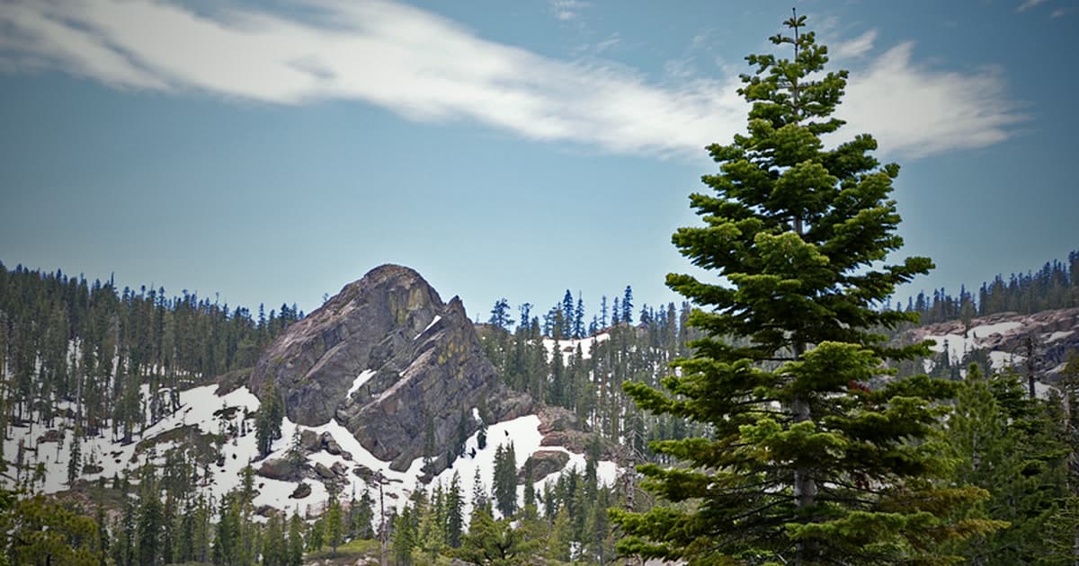
Image credit: Rick Cooper, CC BY 2.0. Original image. License. Cropped and color-adjusted.

More from the Journal
Plumas County Hidden Gems: What to Do Beyond the Obvious
The underrated Sierra Nevada county that most California travelers have never heard of — and why that's the point. A guide to Plumas County's best kept secrets.
Gold Lake Basin: The Best Day Trip from Our Graeagle Cabin
30+ alpine lakes within 15 minutes of the cabin — swimming, kayaking, fishing, hiking, and Sierra Nevada scenery that rivals anything in California.